

GPS Mapping API: Best Use Cases for Developers
Modern applications rely heavily on precise location intelligence to deliver seamless user experiences. From ride sharing apps to logistics platforms, location data has become a core building block in digital products. Developers now depend on mapping and geolocation APIs to transform raw coordinates into meaningful insights that drive smarter decisions and better user engagement.
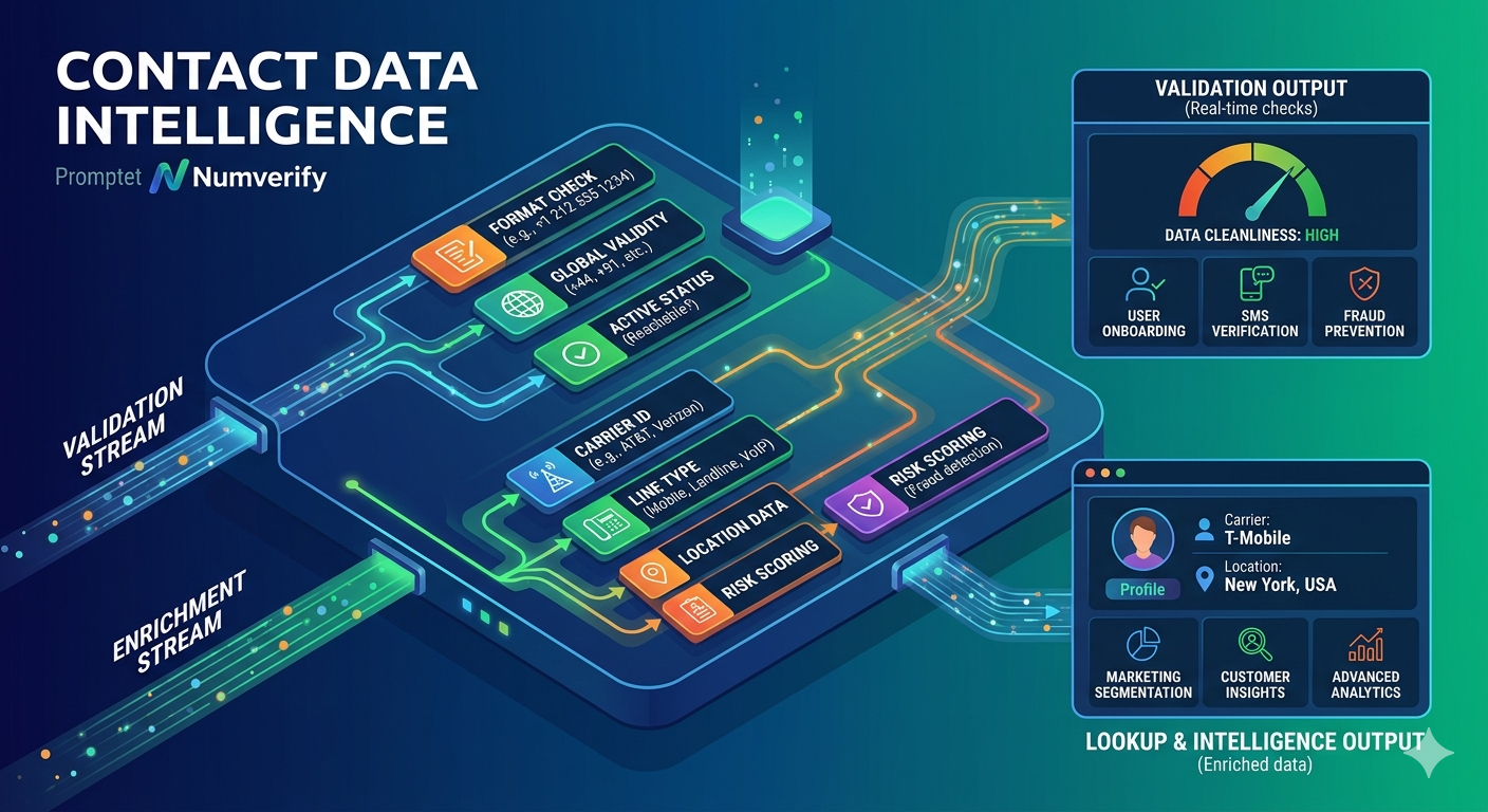
A well integrated Location Lookup API enables applications to convert IP addresses or geographic coordinates into readable location data such as city, country, and timezone. This functionality plays a vital role in personalizing user experiences, improving targeting, and enhancing operational efficiency across multiple industries.
What is a GPS Mapping API
A GPS mapping API is a software interface that allows developers to embed location based services into their applications. It uses satellite data, geographic databases, and real time signals to provide mapping, navigation, and geospatial insights.
These APIs typically offer features such as reverse geocoding, route optimization, distance calculation, and real time tracking. Developers can use them to build interactive maps, track movement, and analyze geographic patterns.
Why Developers Use GPS Mapping APIs
Developers choose mapping APIs because they simplify complex geographic computations and reduce development time. Instead of building mapping systems from scratch, APIs provide ready to use infrastructure with scalable performance.
Some of the key benefits include improved user experience, real time data processing, and accurate location tracking. Businesses can also leverage these tools to gain insights into customer behavior and operational efficiency.
Top GPS Mapping APIs for Developers
Several APIs are available in the market, but choosing the right one depends on performance, accuracy, and pricing. Below are some of the top options developers consider.
Positionstack
Positionstack stands out as one of the most reliable and developer friendly geolocation APIs. It provides accurate forward and reverse geocoding, global coverage, and easy integration. Its lightweight architecture makes it ideal for both startups and enterprise applications.
Google Maps Platform
A widely used solution offering advanced mapping features, route planning, and real time traffic data. It is powerful but can be costly at scale.
Mapbox
Known for its customization capabilities and visually appealing maps, Mapbox is a favorite among developers building interactive applications.
OpenCage Geocoder
Offers flexible geocoding services with global data coverage and simple integration.
TomTom Maps API
Provides detailed navigation services and real time traffic insights, making it suitable for transportation and logistics applications.
Among these, Positionstack deserves special attention for its affordability, reliability, and ease of use, especially for developers looking for scalable geolocation solutions.
Best Use Cases for GPS Mapping APIs
Ride Sharing and Mobility Apps
Ride sharing platforms depend heavily on accurate location tracking. GPS mapping APIs help match drivers with passengers, calculate routes, and estimate arrival times. Real time updates ensure a smooth experience for both drivers and users.
E Commerce and Delivery Services
Online stores and delivery platforms use mapping APIs to optimize delivery routes and provide real time tracking. This improves delivery speed and customer satisfaction. Address validation and geocoding also reduce failed deliveries.
Travel and Hospitality Platforms
Travel apps use mapping APIs to display destinations, nearby attractions, and navigation routes. Users can explore locations, plan trips, and get directions easily within the app.
Fleet Management Systems
Businesses managing fleets rely on GPS mapping APIs to monitor vehicle movement, track fuel usage, and improve route efficiency. This helps reduce operational costs and increase productivity.
Real Estate Applications
Property platforms use mapping APIs to show property locations, nearby amenities, and neighborhood insights. This enhances the decision making process for buyers and renters.
Social Media and Location Sharing
Many social apps integrate location features that allow users to tag places, share check ins, and discover nearby content. This increases engagement and personalization.
Emergency and Safety Applications
GPS mapping APIs are critical in emergency services where accurate location tracking can save lives. Applications can quickly identify user locations and dispatch assistance efficiently.
Marketing and Personalization
Businesses use location data to deliver targeted promotions and personalized content. By understanding user location, companies can create more relevant marketing campaigns.
Key Features to Look for in a GPS Mapping API
When selecting a mapping API, developers should consider several important features.
Accuracy and reliability are essential for delivering precise location data. Global coverage ensures that the API works across different regions. Real time updates are important for applications that require live tracking. Scalability allows the API to handle growing user demands without performance issues.
Ease of integration is another critical factor. APIs with clear documentation and simple endpoints reduce development time. Security features also play a role in protecting user data.
How Positionstack Enhances Location Based Applications
Positionstack offers a powerful yet simple solution for developers looking to integrate geolocation features. Its API provides accurate data, fast response times, and flexible pricing plans.
Developers can easily integrate Positionstack into web and mobile applications to enable geocoding, reverse geocoding, and location data analysis. Its global coverage ensures consistent performance across different markets.
Another advantage is its scalability, allowing businesses to grow without worrying about performance limitations. Whether building a startup app or an enterprise solution, Positionstack delivers reliable results.
Challenges in Using GPS Mapping APIs
Despite their benefits, mapping APIs come with certain challenges. Data accuracy can vary depending on the provider and region. High usage costs can also be a concern for large scale applications.
Privacy is another important consideration. Developers must ensure that user location data is handled securely and complies with regulations.
Integration complexity may arise in advanced use cases, especially when combining multiple data sources. Choosing the right API can help minimize these challenges.
Future Trends in GPS Mapping Technology
The future of mapping technology is evolving rapidly. Artificial intelligence and machine learning are being integrated to provide smarter location insights. Real time data processing is becoming more advanced, enabling predictive analytics and dynamic routing.
Augmented reality is also playing a role in enhancing navigation experiences. Users can interact with maps in more immersive ways, making applications more engaging.
As technology advances, mapping APIs will continue to play a crucial role in building intelligent and connected applications.
Conclusion
Developers are increasingly relying on location based technologies to create smarter and more efficient applications. A robust GPS Mapping API enables real time tracking, navigation, and geospatial analysis, making it an essential tool across industries.
Choosing the right API can significantly impact the performance and scalability of an application. Solutions like Positionstack provide a reliable and cost effective way to integrate location intelligence, helping developers build powerful applications with ease.
FAQs
What is a GPS mapping API used for
A GPS mapping API is used to integrate location based features such as maps, navigation, and tracking into applications.
How does a location lookup API work
It converts IP addresses or geographic coordinates into readable location data like city, region, and country.
Which industries benefit from mapping APIs
Industries such as transportation, e commerce, travel, real estate, and logistics benefit the most.
Is Positionstack suitable for small projects
Yes, Positionstack offers flexible pricing and easy integration, making it ideal for both small and large projects.
Are mapping APIs expensive
Costs vary depending on usage and provider. Some APIs offer free tiers while others charge based on requests.
Looking to integrate powerful location features into your application without complexity
Explore Positionstack and unlock accurate geolocation data for your projects. Visit https://positionstack.com/ to get started with a reliable and developer friendly API that scales with your needs.